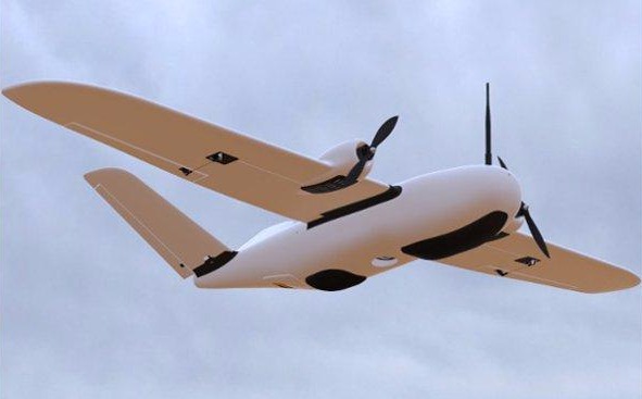
develop free website

Fixed Wing

Professional fixed wing drones are the ideal tool for aerial data acquisition faster and further. They can cover large surface per flight time, flying smoothly and stable along the way. 

Long Endurance

More than one hour per take off.

Heavy payload 

Fixed-wing UAV has a maximum safe payload of up to 1.5kg

Fast Data capture

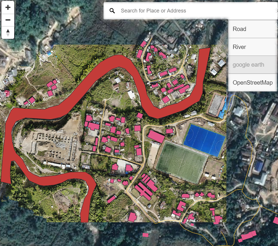
4 Sq Km per Take off
<15 Sq Km per day

nevarsystems

Web Portal and AI based Analysis

Data Acquisition

The fixed wing and multi-copter UAV were selected for the proposed survey. It can be easily carried the different sensors. 
UAVs has been used to acquire the high resolution aerial images for required GSD.

Data Processing

Aerial Images are the major input for data processing. Specific photogrammetric software was used to create different outputs : 2D Ortho (RGB, Multispectral, Thermal), DSM/DTM, 3D Modeling,

nevarsystems

Data Analysis with AI

The integration of AI in GIS creates meaningful insights for different Industries. 


WebGIS

Our webgis platform executes a visual intelligence workflow. It creates the workspace to view, share, manage and collabrate.

Address

NEVAR Systems Pvt Ltd 
Atal Incubation centre,
Pondicherry Engineering College,
Pondicherry. 605 014

Contacts

Email: info@nevarsystems.com
Phone: +91 9443636296