how to make your own site

Information is the primary source

nevarsystems

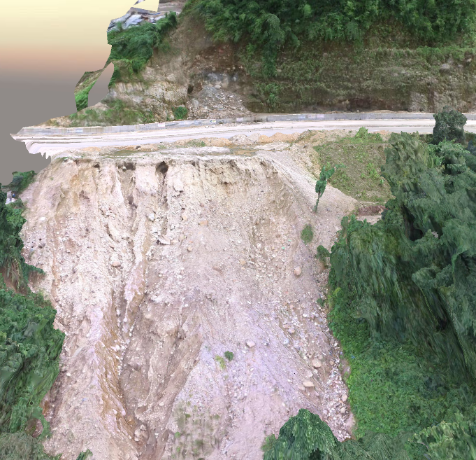
Landslide Monitoring: A landslide is the movement of rock, earth, or debris down a sloped section of land. Landslides are caused by rain, earthquakes, volcanoes, or other factors that make the slope unstable. In this study to collect the high resolution UAV data with GCP points from the landslide area. The 3D modeling and Digital Surface Modeling (DSM) was generated from the UAV images.

Construction Monitoring: 
The data in terms of drone images from multiple locations and point clouds can be used to construct a 3D model using the photogrammetry techniques. This 3D model can be compared to CAD file and BIM model at various construction stages to monitor the construction progress.

nevarsystems
Address

NEVAR Systems Pvt Ltd
Atal Incubation centre,
Pondicherry Engineering College,
Pondicherry. 605 014

Contacts

Email: info@nevarsystems.com
Phone: +91 9443636296